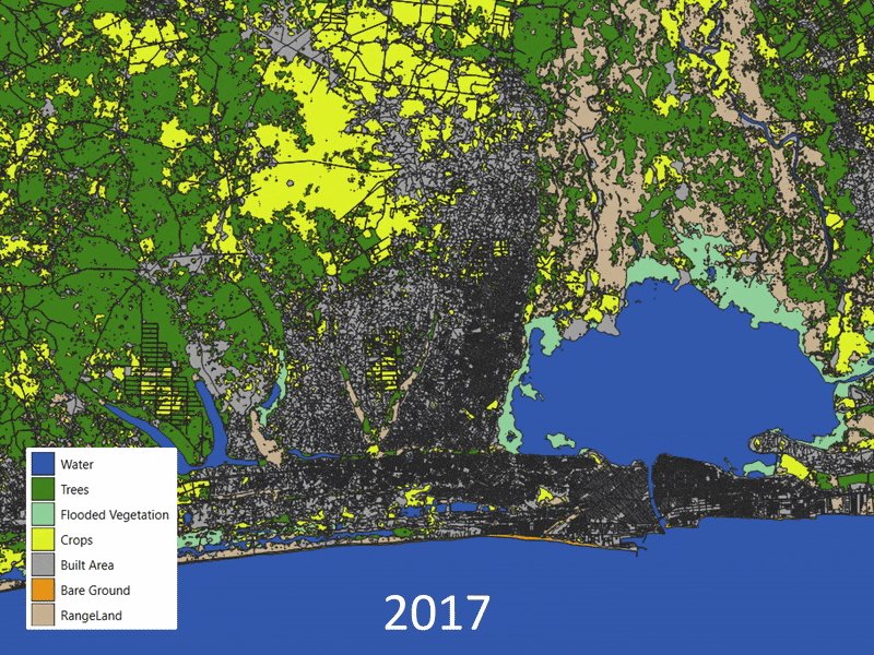
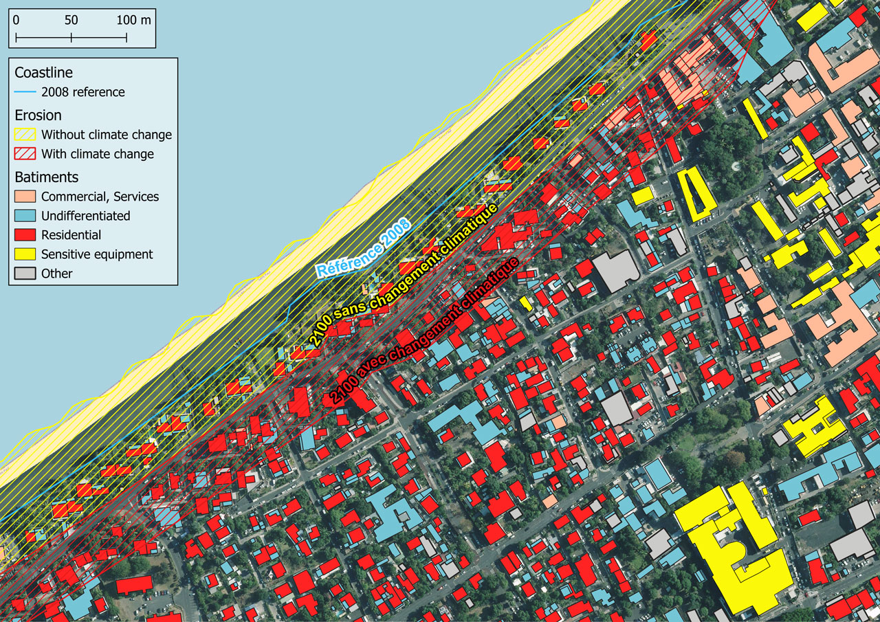
Wildfire risk assessment
The SENWISE (ESA SUP) objective is to anticipate next-generation Sentinel satellite capabilities by simulating resolution-enhanced data for wildfire risk assessment.
- Resolution enhancement
- Land Surface Temperature monitoring
- Vegetation health assessment


- France - Italy - Belgium


- France - Italy - Belgium
Territories and climate
The project covers land-use planning, urban sprawl management, preservation of natural areas and flood risk assessment.
- Evolution of land use
- Flood zone mapping
- Infrastructure and population exposure


- Benin