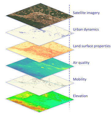
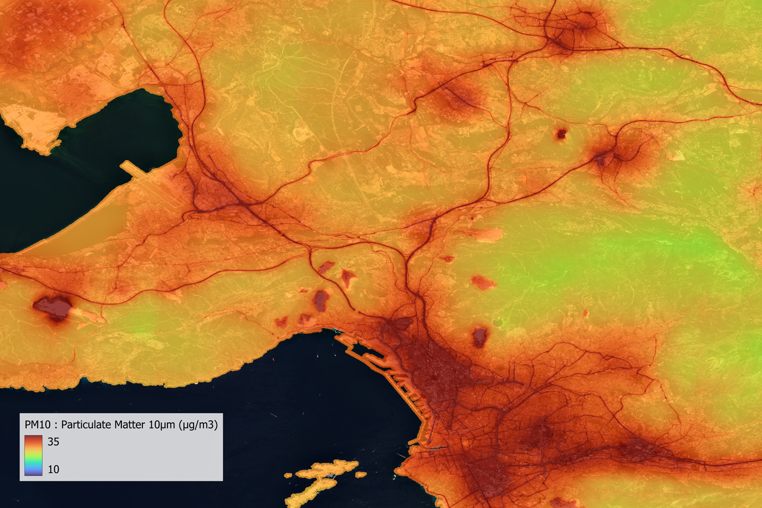
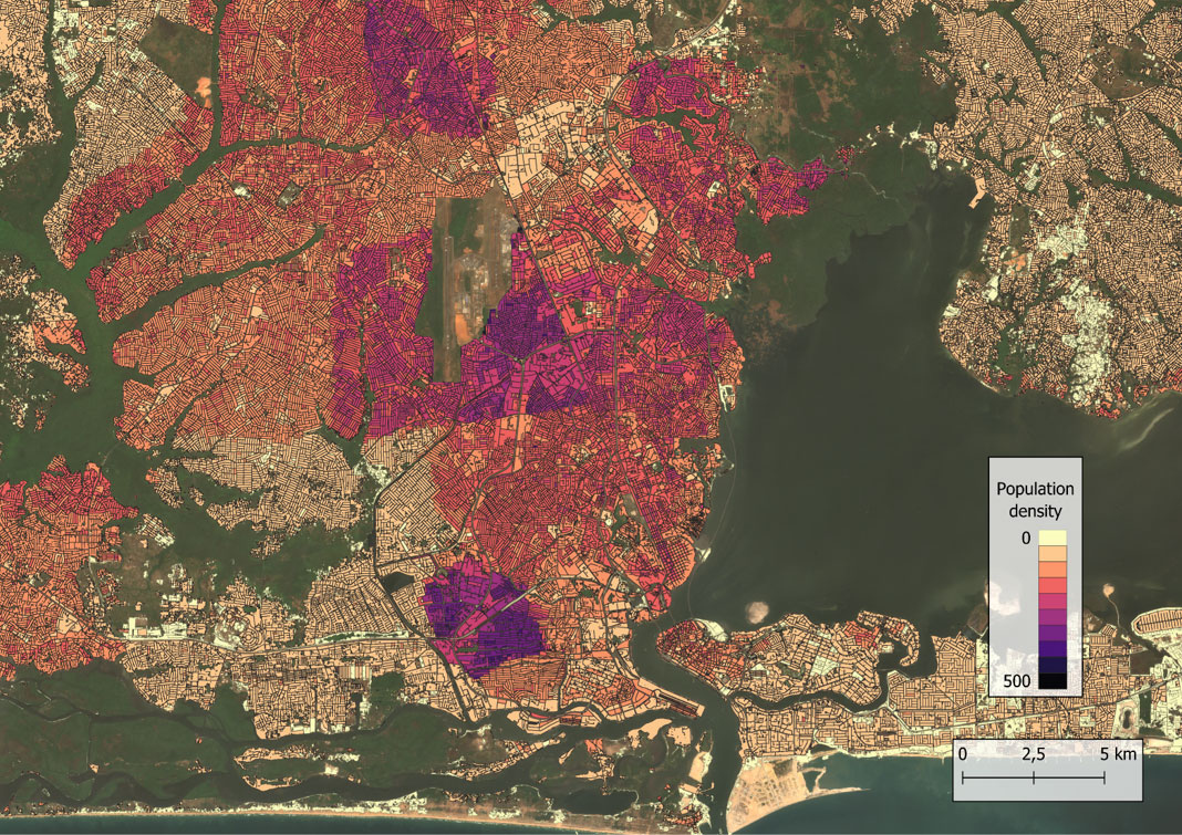
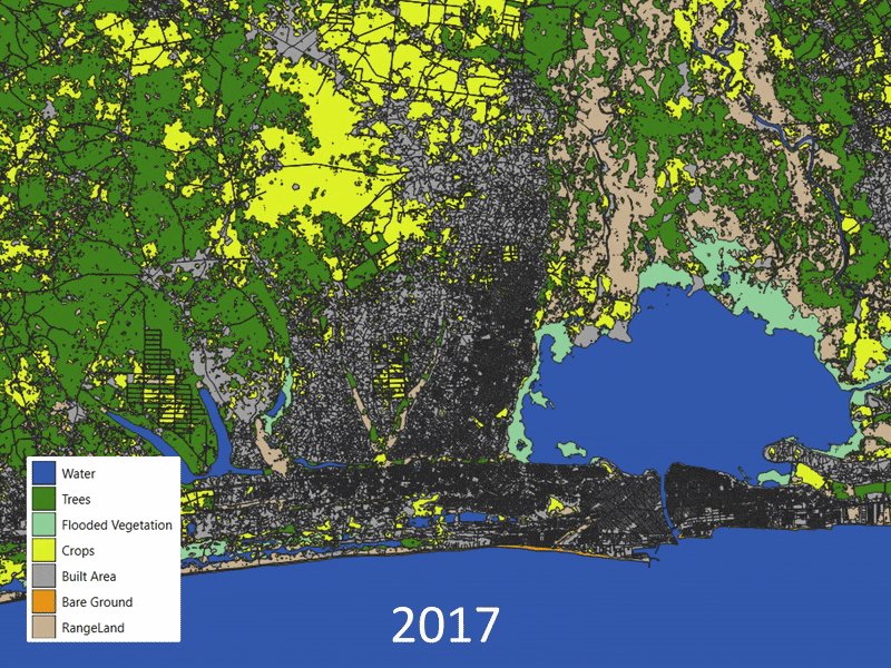
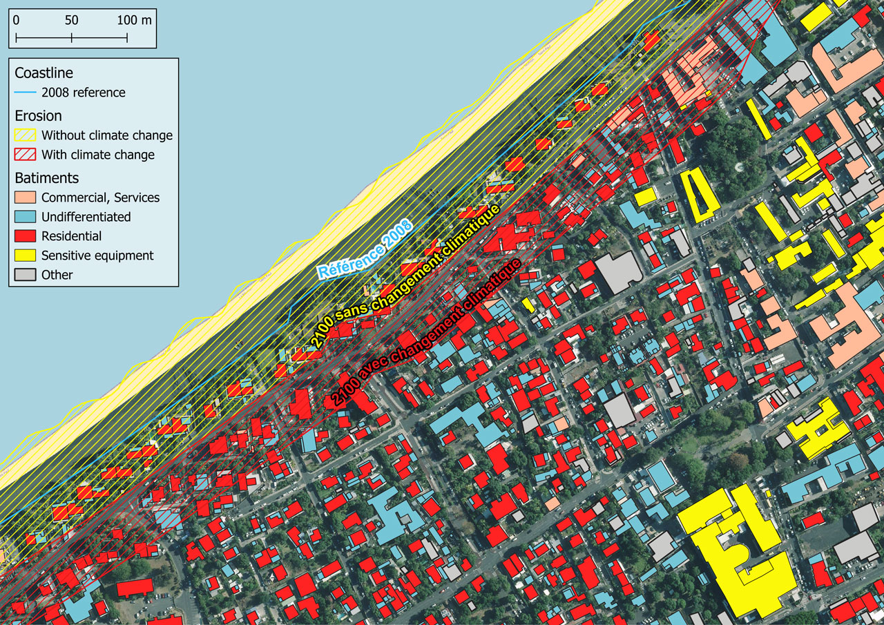
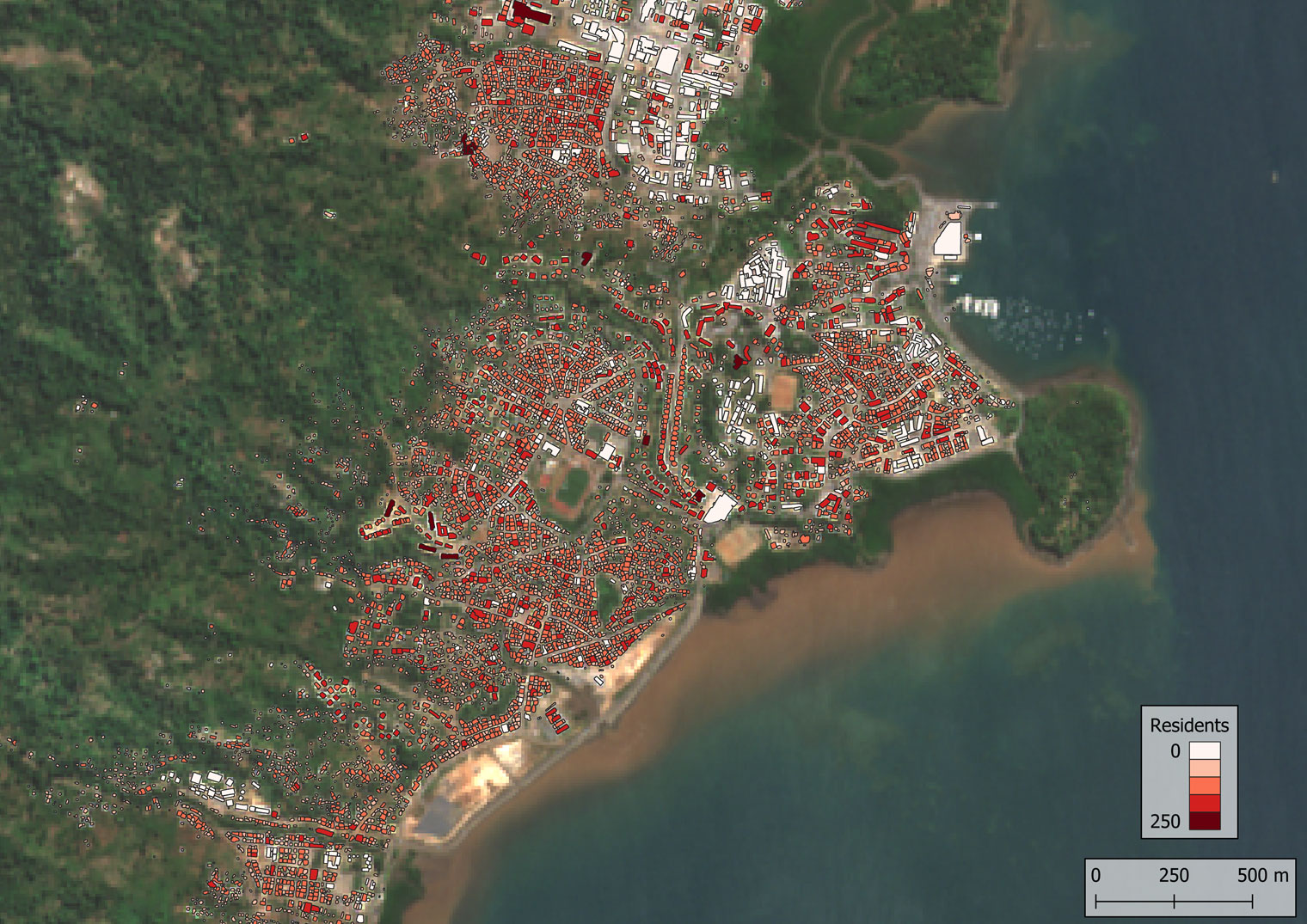
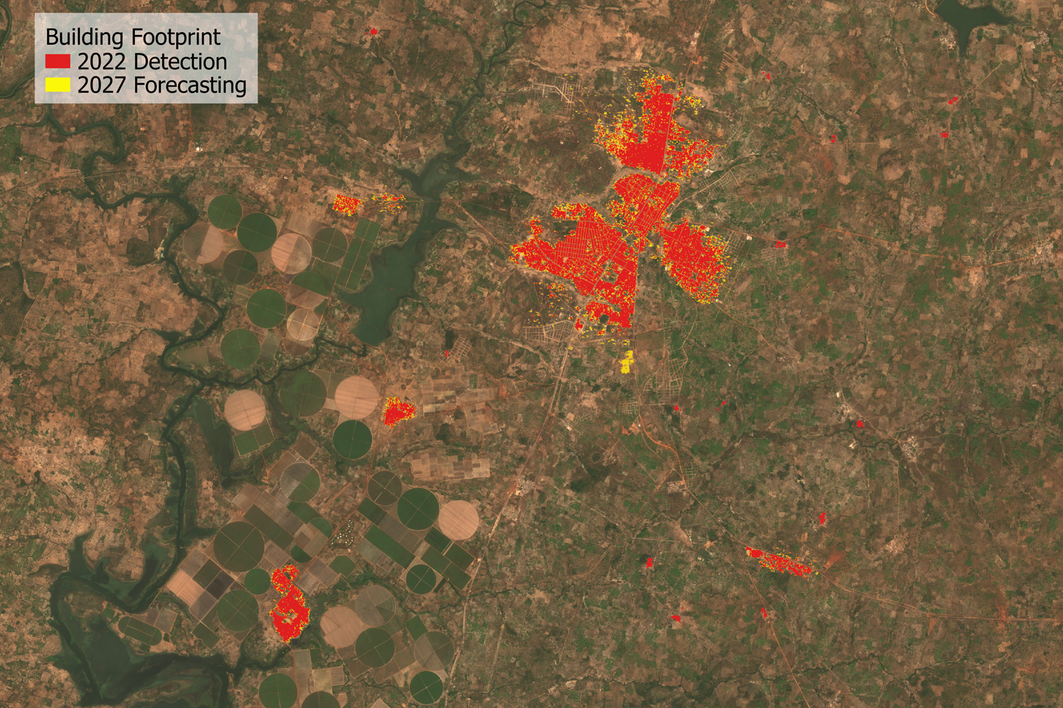
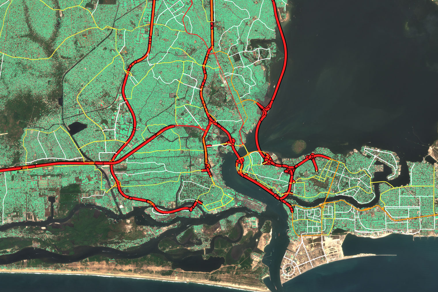
TeleCense revolutionizes urban analysis by combining AI, demographics and multi-source data. It tracks the evolution of cities, optimizes planning and improves access to essential services (telecoms, energy, water, transport). A key tool for intelligent and sustainable urban planning.